Visuals
The opportunity sites
A site-by-site development strategy that turned the Hiram Clarke / Fort Bend Redevelopment Authority's plan of work into four ranked, ready-to-market opportunity sites.
The Hiram Clarke / Fort Bend Redevelopment Authority, which governs City of Houston Reinvestment Zone No. 25, needed to move its 2021-2022 plan of work from strategy to action. BusinessFlare® translated that plan into a concrete, prioritized set of development opportunities across the zone's southwest-Houston footprint.
The engagement inventoried available land, mapped land use across the zone, and ranked four opportunity sites along the S. Main Street / US-90A and W. Fuqua corridors. Each site was profiled with a walking-radius market summary and a set of development options the board could carry to landowners, developers, and funders.
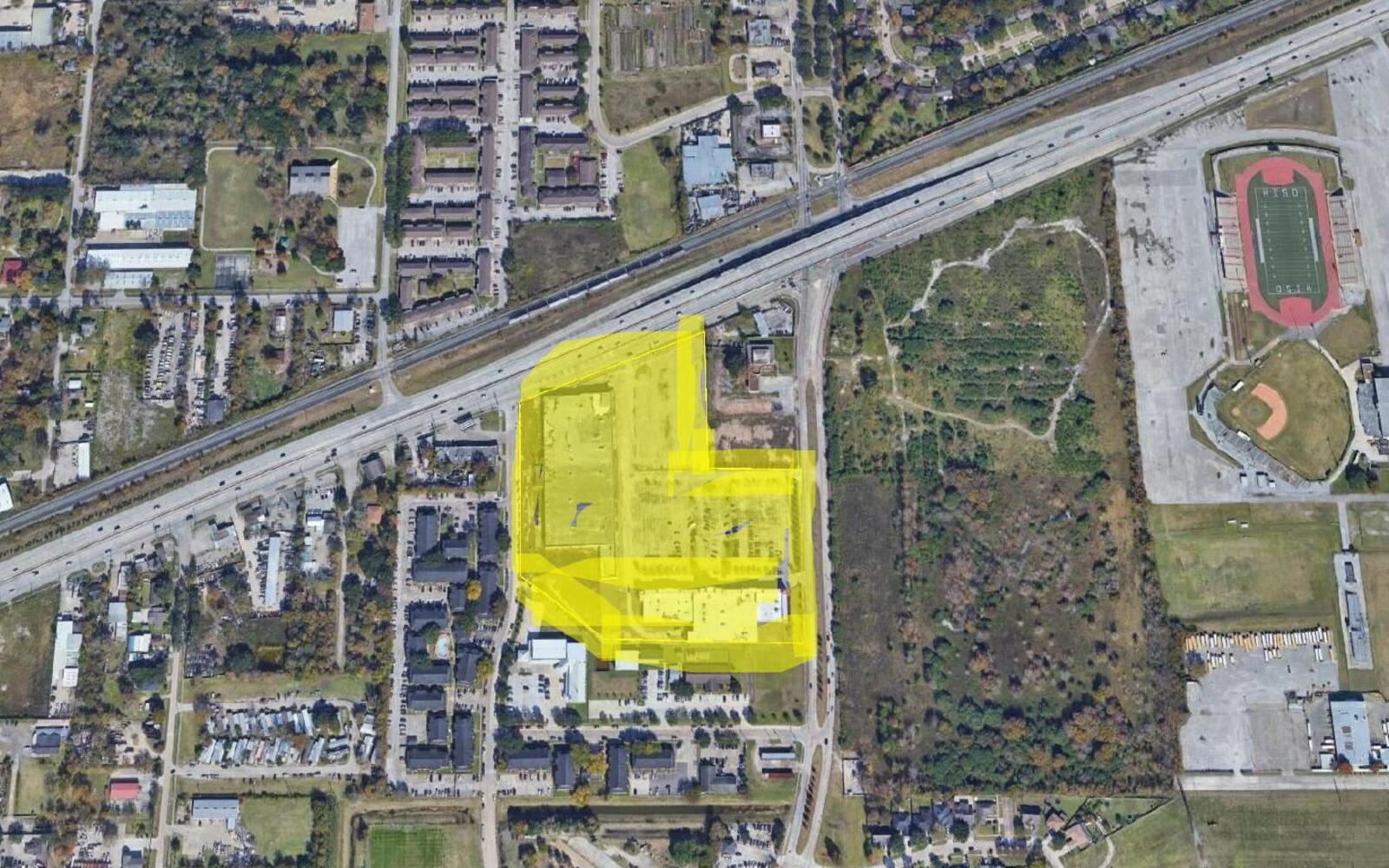
The zone's growth potential concentrates in four sites totaling roughly 24 acres — led by the 14.2-acre South Main Street building parcel — but realizing it depends on the Authority forming public-private partnerships, standing up a Developers Bureau, and creating infrastructure incentives to make the tracts attractive to the development market.
How the plan of work became a ranked, market-tested development pipeline.
The plan's core strategy was to form public and private partnerships to guide land development within the zone — surveying and inventorying available land, studying best uses, and building a growth plan to promote to landowners, developers, and funders.
The zone's largest priority parcel was profiled with three scalable development options, from reusing the existing building to a full 14-acre buildout.
Three additional sites were prioritized and market-profiled, ranging from small infill retail to a combined 7.6-acre assemblage — with a recommendation to create infrastructure incentives where no specific site had yet been identified.
Each opportunity site was analyzed with walking- and driving-radius market summaries and a five-mile overview, alongside a grouped land-use map of the zone identifying single-family, commercial, industrial, and undeveloped tracts.
The deliverable closed with a concrete next-steps roadmap for taking the opportunity sites to market and organizing the development ecosystem around them.